
May 28-29, 2026, 8 AM – 4 PM
(Same time for Both Days)
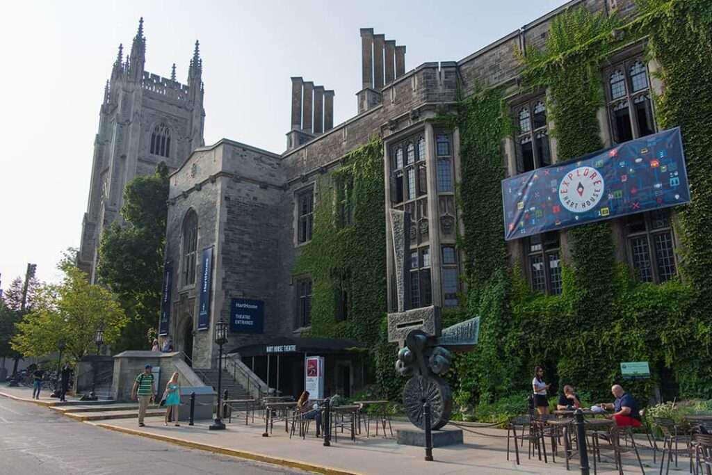
Hart House, 7 Hart House Cir, Toronto, ON M5S 3H3


Itinerary
Date: May 28-29, 2026, 8 AM – 4 PM
(Same time for Both Dates)
Location: Hart House, 7 Hart House Cir, Toronto, ON M5S 3H3
More Info Coming Soon!
– Stay tuned –


Prompts

With human civilization moving towards interstellar expansion, studying exoplanetary systems has become essential. Colonization of exoplanetary systems can ensure long-term species survival in the case of planetary catastrophes like climatic change, extraterrestrial destruction, exhaustion of resources, etc.
Astronomy
However, current detection techniques such as transit photometry and radial velocity favor large, close-orbiting planets like “hot Jupiters” and miss smaller, Earth-type planets which rest in habitable temperate zones. What other data must be measured to better detect Earth-like exoplanets? How can exoplanetary systems be classified to better prioritize future attempts at colonization?

Over 95% of home security camera video surveillance is never viewed, and the majority of footage only wastes storage and energy. With the surge in home surveillance systems, there has been a dramatic increase in energy usage, carbon emissions, and demand for data centers.
Computer Sciences
How can stored video be compressed according to principles of human perceptual science to reduce storage needs without compromising perceived quality? How can “useful” footage be automatically identified using sensor data from the camera system or nearby devices? What algorithms and edge-processing techniques make this system scalable, privacy-conscious, and precise?

With more than 43 million blind individuals and another 295 million people with moderate-to-severe visual impairment around the globe, the need for assistive technology is widespread. Current assistive technology like white canes and simple audio cues lack real-time spatial perception, putting the user in danger within changing environments.
Life Sciences
What sort of wearable navigation system can be designed to construct a 3D “sound map” of space to enhance independent spatial awareness? How can the device be lightweight, discreet, and affordable? How can this technology be implemented for different levels of vision loss?

As cities grow and land becomes scarce, there’s often no room between skyscrapers to build ground-supported infrastructure for secondary routes or local connectors. Transportation systems must directly connect infrastructure with minimal reliance on the ground.
Engineering
What kind of in-sky transportation system can adapt dynamically by being modular while weaving through urban space? How can this system detect and respond to surrounding factors such as traffic, infrastructure stress, and weather conditions? What structural requirements must be met for the system to remain lightweight, cost-effective, and compatible with sustainable mobility (electric vehicles, public transit, cycling, etc.)?

With human civilization moving towards interstellar expansion, studying exoplanetary systems has become essential. Colonization of exoplanetary systems can ensure long-term species survival in the case of planetary catastrophes like climatic change, extraterrestrial destruction, exhaustion of resources, etc.
Astronomy
However, current detection techniques such as transit photometry and radial velocity favor large, close-orbiting planets like “hot Jupiters” and miss smaller, Earth-type planets which rest in habitable temperate zones. What other data must be measured to better detect Earth-like exoplanets? How can exoplanetary systems be classified to better prioritize future attempts at colonization?

Over 95% of home security camera video surveillance is never viewed, and the majority of footage only wastes storage and energy. With the surge in home surveillance systems, there has been a dramatic increase in energy usage, carbon emissions, and demand for data centers.
Computer Sciences
How can stored video be compressed according to principles of human perceptual science to reduce storage needs without compromising perceived quality? How can “useful” footage be automatically identified using sensor data from the camera system or nearby devices? What algorithms and edge-processing techniques make this system scalable, privacy-conscious, and precise?

With more than 43 million blind individuals and another 295 million people with moderate-to-severe visual impairment around the globe, the need for assistive technology is widespread. Current assistive technology like white canes and simple audio cues lack real-time spatial perception, putting the user in danger within changing environments.
Life Sciences
What sort of wearable navigation system can be designed to construct a 3D “sound map” of space to enhance independent spatial awareness? How can the device be lightweight, discreet, and affordable? How can this technology be implemented for different levels of vision loss?

As cities grow and land becomes scarce, there’s often no room between skyscrapers to build ground-supported infrastructure for secondary routes or local connectors. Transportation systems must directly connect infrastructure with minimal reliance on the ground.
Engineering
What kind of in-sky transportation system can adapt dynamically by being modular while weaving through urban space? How can this system detect and respond to surrounding factors such as traffic, infrastructure stress, and weather conditions? What structural requirements must be met for the system to remain lightweight, cost-effective, and compatible with sustainable mobility (electric vehicles, public transit, cycling, etc.)?

